Applications
alias
atlas
bruwater
solar map
brugeoTool
dashboard
embed
infiltrasoil
login
metadata
plans & projects
query
studio
terms
Components
Administration
embed : A simplified map viewer for publishing a map on a third party site
How to embed a map from cartostation in another site?
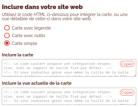
The simplest solution consists in copying the code proposed on a map in the atlas application, and to insert it in the HTML code of the page of your site.

Note : In the case of a manual embed, the person creating the iframe must make sure that the map url points to the application embed, and not to atlas.
URL structure
URLs are structured according to the following model: [deployment-url]/client/embed/[map-ID]?profile=[profile-type]&lang=[language_code]
Profile selection
Different profile types are available:
simpleall-toolsfull-screen
Example of use:
[deployment-url]/client/embed/[map-ID]?profile=full-screen
simple profile
- Language switch
- Link to Atlas
- Title
- Description
- Caption
- Display information when clicking on the map

all-tools profile
Simple Profile +
- Address search
- Zoom buttons

full-screen profile
- Language switch
- Link to Atlas
- Display information when clicking on the map

Language selection
The language of the embedded map can be configured in the URL using the language parameter. For example: lang=en or lang=fr
Example of use:
[deployment-url]/client/embed/[map-ID]?lang=en
Example of combined profile + language usage:
[deployment-url]/client/embed/[map-ID]?profile=fancy&lang=en
Iframe size
Maps embedded in third-party sites are generally constrained by the layout in which the iframe will be inserted.
However, it is still important to adjust the size of the iframe to the content of the map, particularly in terms of the size of the description, the legend and the information available.
A size of 1000x600px is generally the minimum required to display the information comfortably.
Recommended practices for creating maps intended to be placed in an iframe
- Adjust the map content to match the editorial content of the site. If the content and context of the map are already included in the site page, the map description can be concise. Its title can also be adapted.
- Use a simple, understated legend
Practices to avoid
Embedding an Atlas map in an iframe is not recommended. An Atlas map includes many additional tools and is not suitable for use on a third-party site.
A button is available from the embed iframe to view the map with all its tools in the Atlas of the mapping portal.
Visibility of the application
embed is an application that is not intended to be visible as a stand alone application in the user menu. However, it must be activated during cartostation deployment to be usable.
This application is automatically used when the third party site publication code is copied from the corresponding widget in atlas.